Cartographic projects
Social Cartography
Social or participatory cartography is an instrument of intervention, not only of knowledge or approximation, since by acting so intensely with the actors that are part of its application processes, they generate new inscriptions and marks in these. It is possible to think of this same effect at a territorial level, since cartography not only describes from the objective and the subjective, but also makes us see what goes unnoticed, lacking articulation or imminent meaning, recovering it and often transforming it into a significant event through territorial level (Diez et. al., 2012).
This activity has been present through workshops and dynamics in most of the local, educational and community intervention projects that we have carried out. Through social cartography, the people who own the territory are directly involved in the representation of their environment, in the identification of their resources and in their organization. Participatory cartography is a means of expression for communities and an exercise for the development of creativity, imagination, consensus, the identification of problems and the presentation of proposals for improvement. Therefore, it is a good technique for qualitative research, social engagement and self-diagnosis within community projects.


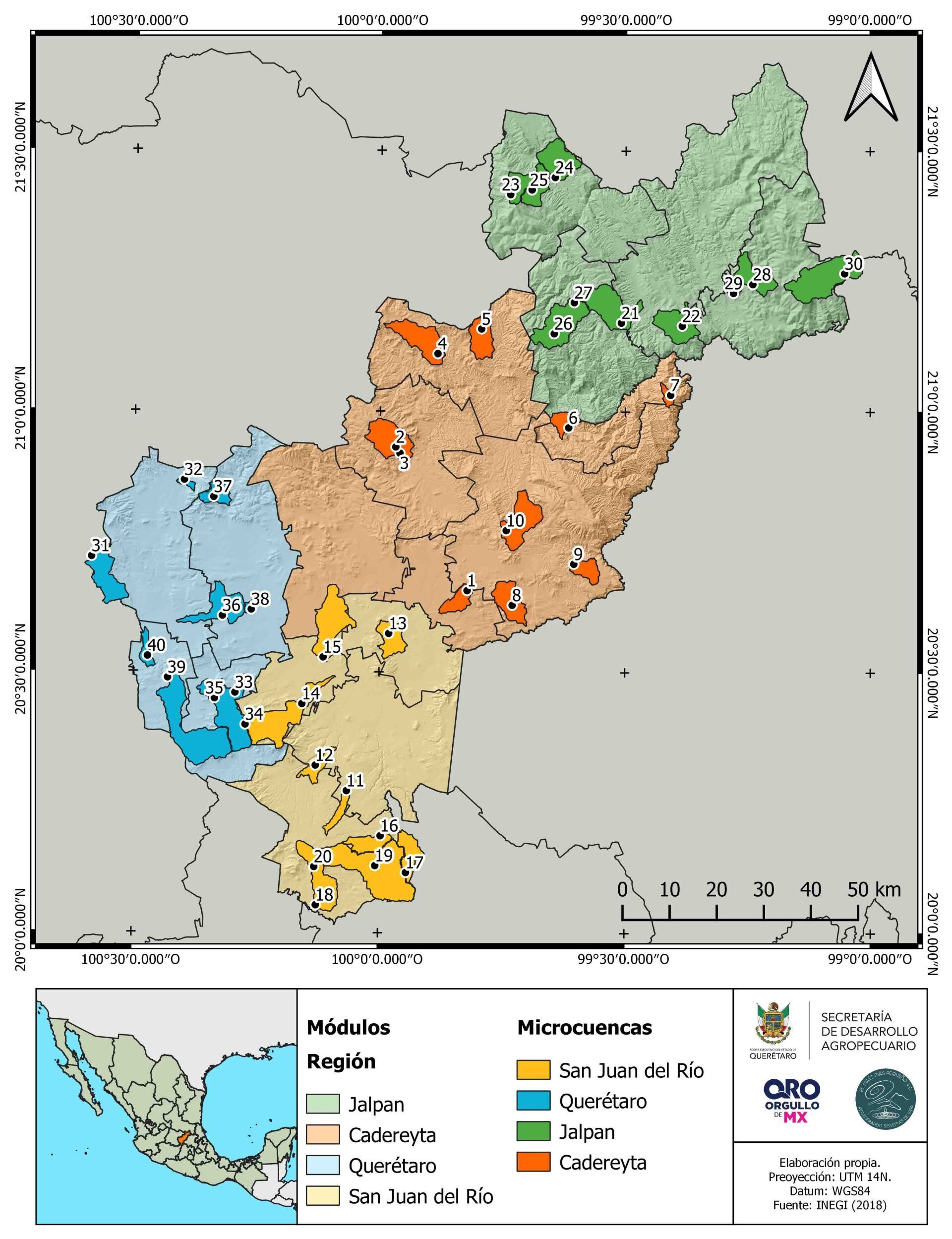
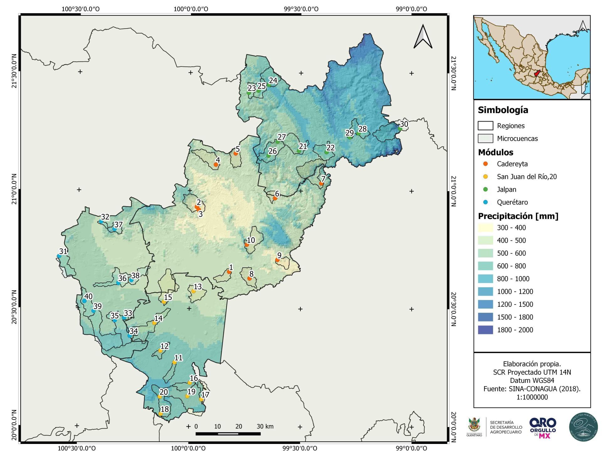
Geographic Information Systems Project (GIS) applied to micro-watersheds and demonstration modules in the State of Querétaro
Within the framework of the project "Installation of backyard gardens and rainwater harvesting systems in localities with high and very high marginalization", the project "Geographic Information Systems (SIG) was carried out between the months of August and November 2020. applied to micro-basins and demonstrative modules in the State of Querétaro” whose final document was considered as a highly relevant work by the Secretary of Agricultural Development Ing. Carlos Heinz Dobler Mehner as strategic information for decision making.
The objective of this project was to use cartography (GIS) as a tool for recognition and administration of the territory for the adequate management of water, soil, biodiversity, food production, resources and ecosystem services, which allows move towards a model of agroecological ordering planned in the communities, with a vision of watersheds as a system of life.